Aside from Antarctica, which still doesn’t have a permanent presence today, the Americas were the last continents to which people made their way. Most, though not all, of our ancestors evolved in Africa; Homo erectus or even earlier hominins arrived in Eurasia by no later than 1.8 million years ago and almost certainly hundreds of thousands of years before that; a variety of different species, including Homo heidelbergensis and Neanderthals have made Europe their home over the last million or so years; and Homo sapiens crossed the narrow seas to Australia no later than 50,000 years ago.
And yet the Americas remained devoid of human habitation until somewhere between 30,000 and 15,000 years ago, far later than every other inhabitable continent. How could that be? The Great Plains teemed with herds of mammoth, bison, and wild horse. The rivers of the Pacific coast were full of salmon. Kelp forests extended offshore in the shallow waters from the Pacific Northwest all the way down to Chile, creating a freeway of fish and marine life that could sustain coastal migrants. By any standard, there were plenty of great places to live in North and South America. What was the problem? What took them so long?
The first barrier the first Americans faced was the vast, frigid expanse of eastern Siberia, a mass of rugged hills, windswept valleys, and open tundra that experience some of the coldest and harshest conditions on the planet. Reaching the comparatively (and paradoxically) milder conditions nearer the Arctic Circle meant crossing this enormous and occasionally outright impassable barrier. That meant developing a technological and cultural toolkit that allowed for survival in these conditions, which isn’t something that happened overnight.
Eventually they did it, and these migrants got past eastern Siberia between perhaps 30,000 and 23,000 years ago. That’s when the most up-to-date genetic evidence tells us the populations ancestral to present-day Indigenous Americans grew separated from other groups in East Asia. At that point they arrived not in the Americas but in Beringia, what you might have heard called the “Bering Land Bridge.” That’s a misnomer, implying a small and temporary connection left fortuitously above water by the dramatically lower sea levels. Beringia wasn’t some rickety causeway connecting Siberia and Alaska, but a whole enormous region in its own right. At its greatest extent, when sea levels were lowest, the central point of the landmass - underneath what’s now the Bering Sea - was some 500 miles from the nearest ocean. You can see how big it was here, and how it changed over time:

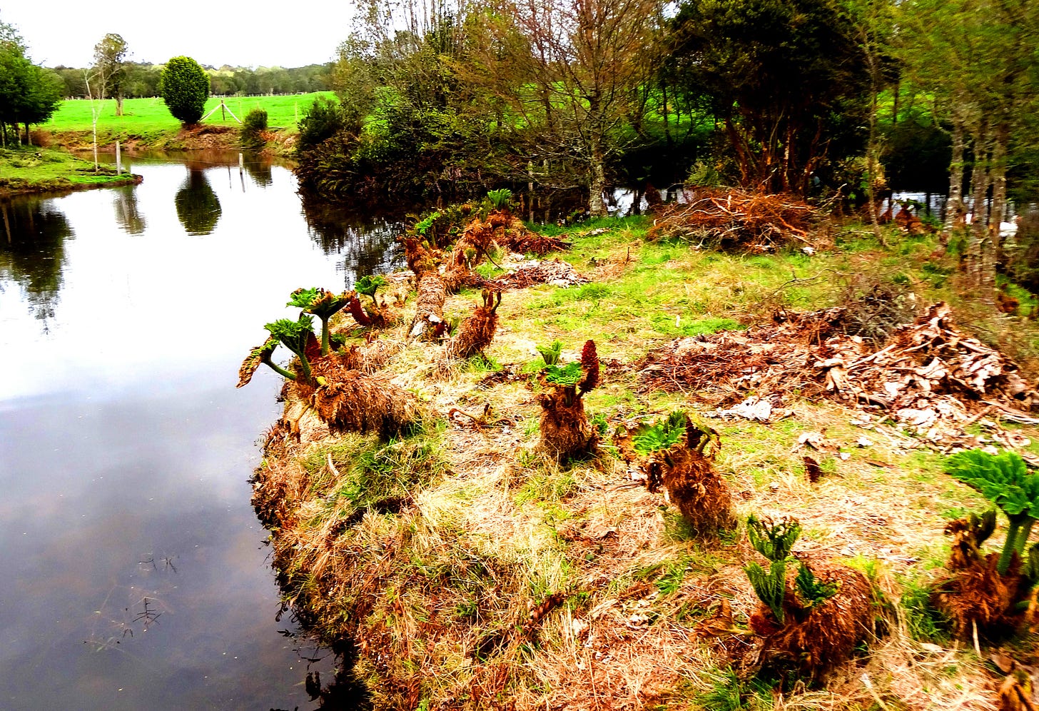
Beringia wasn’t an arctic desert, a tundra devoid of life where people scratched out a living; it was a coastal plain, much of it surprisingly warm thanks to the prevailing ocean currents to the south, where a variety of lifestyles could potentially thrive. There were presumably big-game hunters who subsisted on the herds of large grazers who lived in the mammoth steppe; others were coastal fishermen and foragers. The small founding population that entered Beringia quickly splintered into several groups who took up residence across this vast region, where they probably became isolated from one another for the next several thousand years. These photos are from today’s Bering Land Bridge National Preserve, but the profusion of grassland, flowering plants, and wide-open spaces captures the essence of what people might have seen here 20,000-ish years ago:


But once in Beringia, which extended from eastern Siberia to Alaska and the Yukon beyond, there was nowhere else to go.
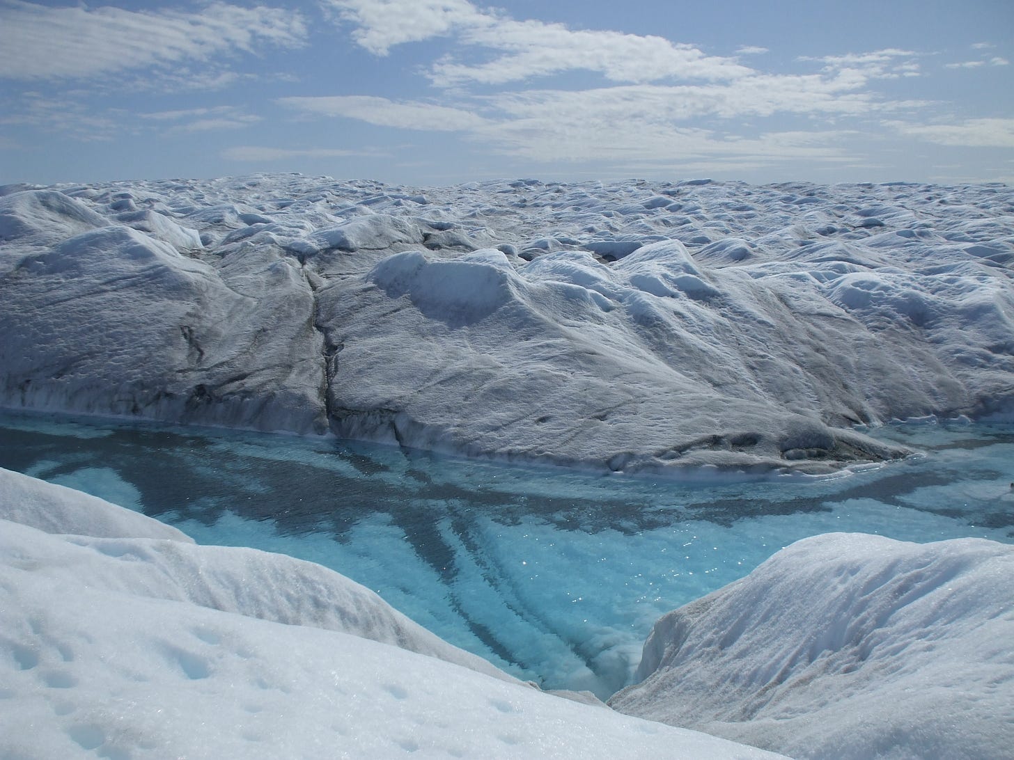
Why? Ice sheets. This was around the Last Glacial Maximum, when the glaciers were at their greatest extent: That’s why the sea levels were so much lower and Beringia was exposed in the first place. If the inhabitants of Beringia had tried to go further south, toward Canada and the Pacific Northwest, they would’ve seen something like this:

And it extended for thousands of miles, an utterly lifeless, impassable, mile-thick pair of ice sheets (Cordilleran and Laurentide) covering almost all of Canada and much of the northern United States. It even extended into the ocean, preventing the Beringians from simply getting in boats and sailing around it. There was nowhere to stop and land, no protection or shelter from storms, nowhere to go. Good luck with that if you tried, which I’d imagine some folks probably did.
It’s possible that some people did succeed in making it past the ice sheets, perhaps by taking advantage of a temporary warm spell to leapfrog past the sea ice and reach the safety of North America. A pair of recent papers in the journal Nature argue for a human presence in what’s now the highlands of Mexico as much as 30,000 years ago. While the evidence is scattered and inconclusive, there’s no a priori reason why small, isolated groups couldn’t have survived for thousands of years, leaving only minute traces of their occupation for us to find millennia later.
I think it’s likely that there were people in the Americas at least 20,000 years ago, just not very many of them. There are tantalizing hints in the DNA of people living in today’s Amazon, and in the ancient DNA of 10,000-year-old remains from Amazonia, that the ancestors of these people interbred with a deeply diverged ghost population, known as Population Y, that harbored some relationship to today’s Australasians. Maybe these were the early migrants, though that’s a long way from certain.
What is certain is that the vast bulk of ancestry in today’s indigenous Americans derives from a series of later population movements, from the people who had come to Beringia and stayed there for a few thousand years. Beginning around 16,000 years ago - perhaps a few thousand years earlier, maybe a bit later - they started to make their way south as the ice sheets began to melt. The coastal route is the most likely option for this migration; they walked along the shoreline and took canoes or boats out into the open water when the ice sheets came all the way to the ocean. By taking this route, they would’ve been able to exploit the same kinds of marine resources for practically the entire journey. Once they reached the area south of the ice, in today’s Pacific Northwest, they could’ve followed one of any number of rivers into the vast, unexplored interior.
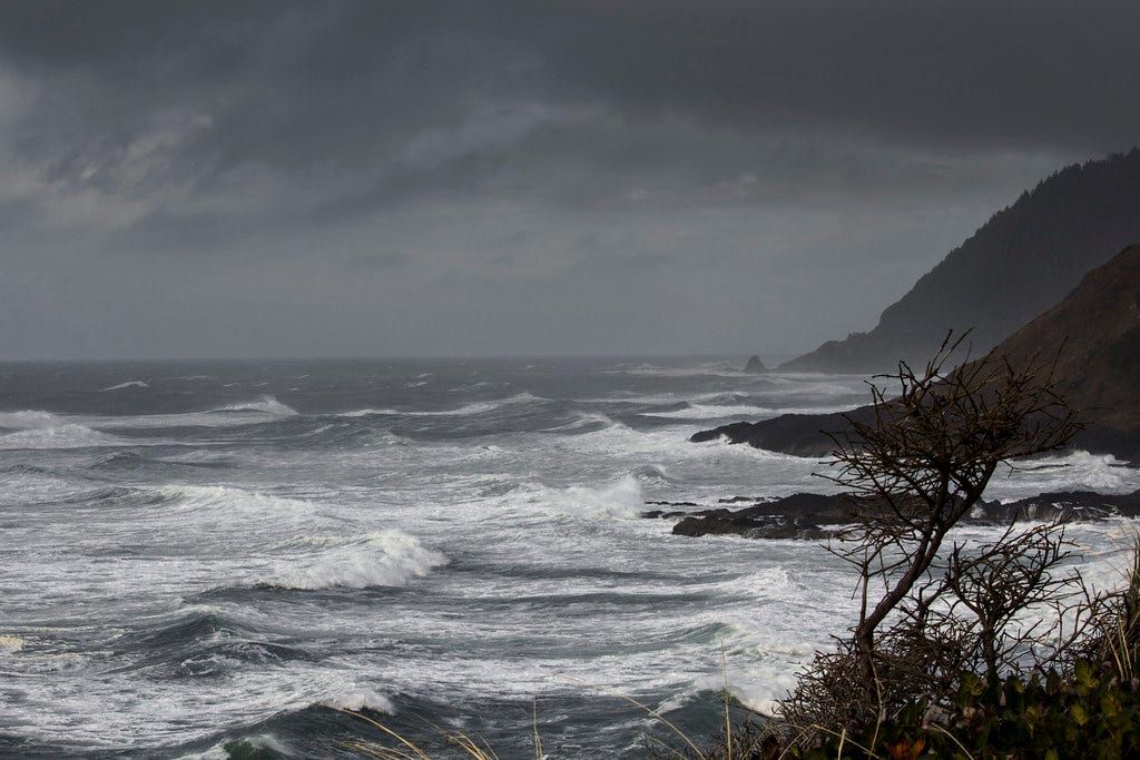
This is all pretty plausible, even likely, but we have to note that there isn’t a lot of hard evidence for it. Why not? Well, probably because the shoreline along which these people traveled is now under hundreds of feet of Pacific Ocean. As the sea levels rose, the rising waters would have obliterated much or all of the evidence for the coastal migration. In any case, we’re probably talking about small groups of people living in temporary encampments, using tools made mostly of wood, antler, and bone. That kind of thing doesn’t preserve well anyway. And if you’ve ever spent time along the Pacific Northwest coast, you know that intense, prolonged rain and storms - the kind of thing that are terrible for the preservation of organic remains - are common occurrences.

But there are a few pieces of evidence pointing toward that earlier route. Coprolites (that’s a fancy way of saying fossilized poop) from Paisley Caves in Oregon that are somewhere between 12,750 and 14,290 years old have yielded human DNA that tracks with a Beringian origin. The Cooper’s Ferry site in Idaho, just a couple of rivers upstream from the Columbia and thus the Pacific, has produced stone tools somewhere around 16,000 years old.
By no later than 14,500 years ago, and maybe even four thousand years before that, people had reached southern Chile. The site of Monte Verde is a marvel; thanks to rising creek waters that formed a peat bog, perishable materials like wooden artifacts, house planks, animal hides, and even fruits and berries were preserved.

Whoever Monte Verde’s inhabitants were, or those of Paisley Caves and Cooper’s Ferry, they were soon joined by another wave of migrants from Beringia. These people probably came south not via the coast but through an ice-free corridor that opened up through Canada. As the grasses colonized this newly viable landscape and the grazers ate them, people from today’s central Alaska and Yukon could’ve followed this walking food supply all the way south into North America.
These were the Clovis people, whom researchers used to believe were definitively the first Americans. We now know this wasn’t the case, but the Clovis people were very real, quite numerous, and extremely successful in exploiting their new environment.
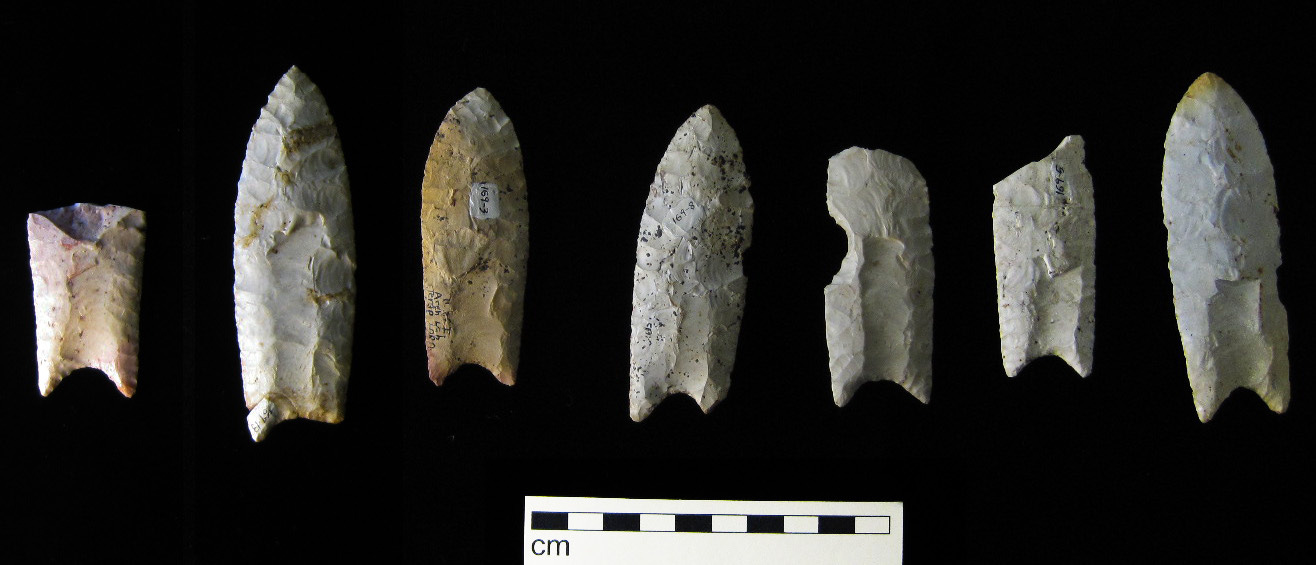
The Clovis people get their name from the town of Clovis, in eastern New Mexico, where folks stumbled onto a type of stone projectile point embedded in the bones of extinct animals. These Clovis points are beautifully made and quite distinctive, with an oval shape and fluting:

They appear all over North America, central America, and the northern reaches of South America with shocking speed. Whoever made them arrived, spread out, and multiplied many times over in a matter of centuries, the blink of an eye considering the timescales we’re working with.
Thanks to ancient DNA, in this case preserved in the 13,000-year-old remains of an infant found in Montana, we know that the Clovis people provided a great deal of the ancestry to today’s indigenous Americans. The story is a little more complicated than that - there were subsequent migrations out of Beringia, the ancient Beringians didn’t go away even after other people went south, and people later came from Siberia after the land bridge disappeared - but at this point we have a pretty good sense for who the first Americans really were.
If you’d like to learn more about the first Americans, check out the most recent episode of Tides of History, my podcast. If you like it, subscribe on the platform of your choice. And if you like these essays and posts, be sure to subscribe to this newsletter as well.


Long time, first time: I loved the last couple episodes and this substack on the Americas. I'm First Nation (Canadian) and have to admit that at times I've struggled with accepting even the basic science because it conflicts with the cultural stories and origin myths we have learned growing up.... BUT...I really am excited that the science is improving and diversifying and painting a richer picture of our shared history. It helps make the scientific story more palpable! : )
PS - loved the bit on the process of collaboration between local indigenous groups and scientists to co-determine a story and what/how to use the "bones" or evidence for. Keep up the great work!
So interesting!! When we learned about a “land bridge” connecting Russia and Alaska in school, you just really never imagined this. Love it!